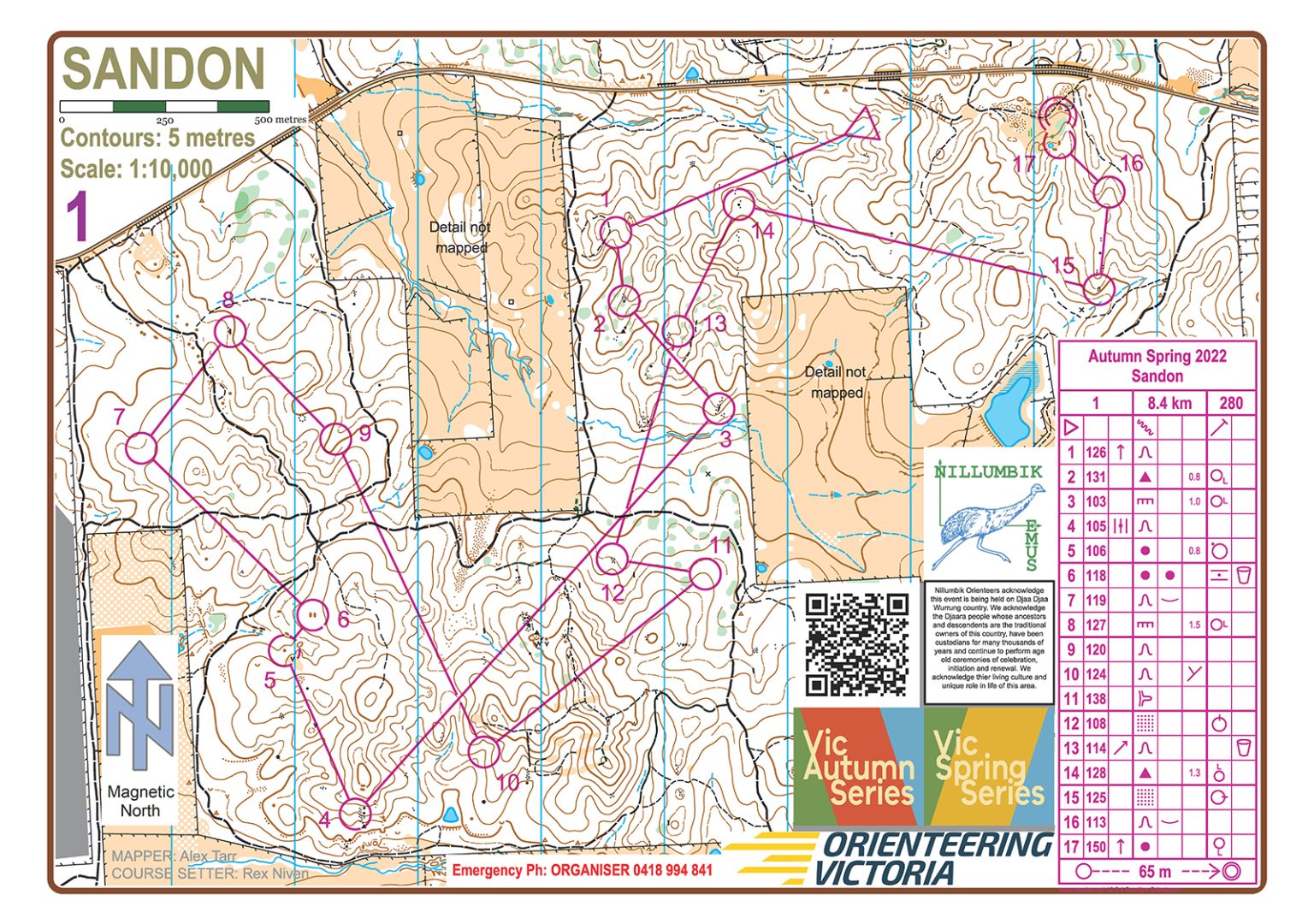
Bush orienteering is the traditional type of orienteering. This is from the origins of the sport in the forests of Scandinavia. It is normally conducted in a non-urban environment. This is usually forested, and things such as rock detail, landform features and changes of vegetation are shown on the orienteering map. The key is to read the detailed map to visit each control point on the course. The aim is to keep in contact with the map and go as fast as you choose to go. You can use a compass to help with direction.
Bush orienteering courses vary in distance and navigational challenge.
Do you take the track and go the long way round, or go straight through the bush? Do you take the shorter, but hillier way, or take a track the long way round? These are the type of decisions that each person makes during their course in bush orienteering.
It’s an awesome adventure-based type of orienteering that caters for all ages and capabilities.
In bush orienteering there are three formats: long distance, middle distance, and relay. In each format there are always a range of courses that have different levels of navigation challenge. An easy navigation course will usually be on tracks in the forest. In a hard navigation course, you often make a route choice. Which cross country route will be the best to get from one control point to the next. Which map information to read to get from one control to the next.
The aim of the long distance format is to challenge your ability to make good route choices between control points. For an easy navigation course this might be which track is best. For a hard navigation course this might be which cross-country route is best. Course lengths vary from target times of 30 minutes to 90 minutes. It is the most physically demanding type of orienteering. Long distance format events can include some middle distance format type orienteering.
The aim of the middle distance format is to challenge your ability to navigate to and between control points. Like the long distance format, there is a range of navigation challenges in courses. A hard navigation course often requires constant concentration on map reading. This is mixed with lots of changes of direction. The balance is between navigation and speed. Easy navigation courses keep you on or close to tracks. Course lengths have a target time of 30 to 35 minutes. It is the most technically demanding type of orienteering. Middle distance format events can include some route choice navigation too.

The Relay format is usually a 3 person team competition. They are normally held at state and national championships. The orienteering is a mix of the technical navigation of the Middle Distance format. The fun part of a relay is that the first leg competitors all start at the same time.
You don’t need a lot of gear to go bush orienteering.
Almost all bush orienteering events use a Sportident card (“stick”) to check the control points you go to and record your time. Don’t worry if you don’t have one, as at events that use Sportident you can either borrow or hire a stick.

So now you know more about bush orienteering it’s time to give it a go. Bring some mates, your family or go by yourself, everyone is welcome!
Your first start point is to visit the events page of each of our member associations.
South Australia and Northern Territory
You can also go to our Eventor page. Eventor is the Orienteering Australia events, results and membership portal that lists all orienteering events across Australia.
Highlights from the 2023 World Championships in Switzerland. The ultimate bush orienteering experience. Click to play.