Orienteering is an exciting and challenging outdoor sport that exercises mind and body. There are options for runners, walkers and cyclists of all ages who want to test themselves mentally as well as physically, or who want to add variety to their leisure activities. It doesn’t matter how young, old or fit you are, as you can progress at your own pace on courses planned to suit you. You decide how quickly you would like to go.
In simple terms you visit locations called “control points” while navigating on a “course” with the aid of a special map.
The exact location of these control points is shown on the map. In most orienteering events you visit these control points in order, although in some events it’s up to you to choose the order.
In orienteering you can run, jog or walk and almost always can choose a course to participate in that best suits you.
In mountain bike orienteering (MTBO) you ride a mountain bike. There is also ski orienteering (SkiO) in places that have lots of snow, and trail orienteering (TrailO) which is all about map reading.
If you go orienteering in the bush, you often use a compass to help you navigate around a course.
Run, jog, walk or cycle!
Every control at every event is a personal challenge. The reward of navigating between controls and getting outdoors for fitness and fun makes it a passion for people of all ages and fitness levels. Orienteering has a very broad appeal – from the participants who choose to jog or walk, right through to the highly competitive orienteers who vie for a spot in Australian teams that compete in World Championships or compete at the World Masters level.
Alone or in a group!
You decide if you would like to head out alone and enjoy the personal challenge or share the experience with friends or family. Many urban events are also wheelchair and stroller friendly.
All ages!
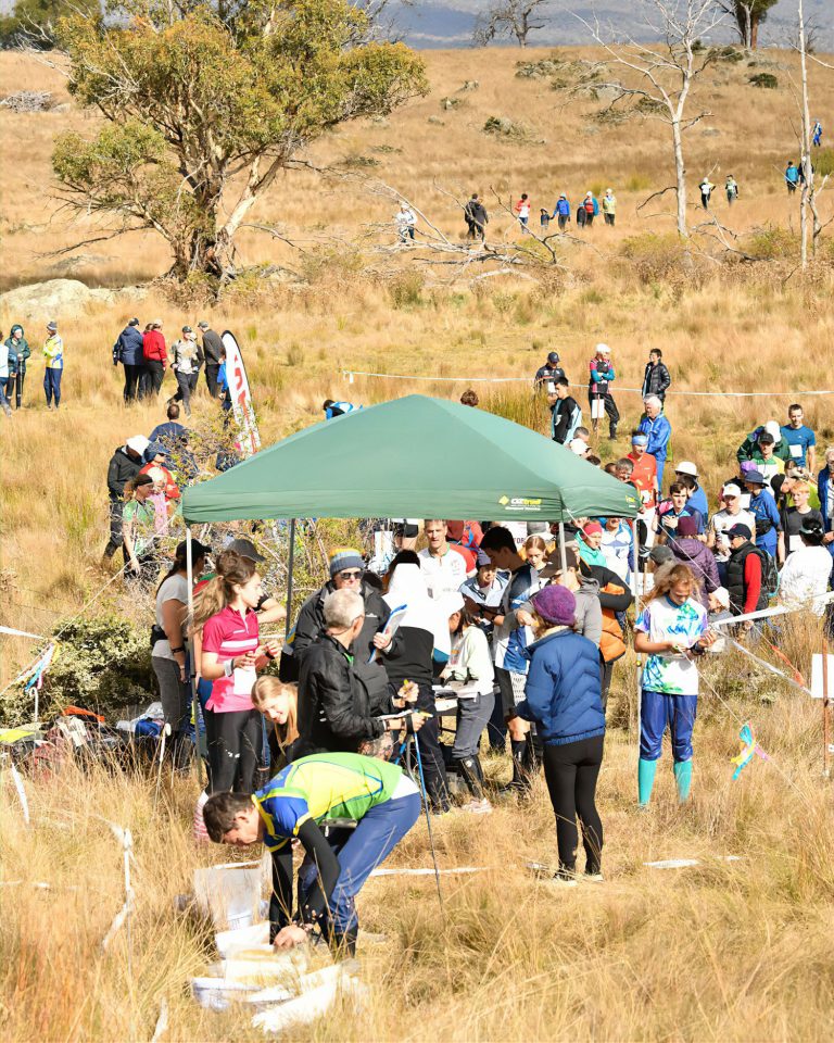
Children often start participating on their own from around 8 years of age. Younger children will usually need some help with the navigation. At major events there are often ‘string’ courses for the very young. Events have courses graduated by both difficulty and distance. There are courses to cater for people right through to the older age groups. Masters competitions even include over 90 year olds. So, bring the family or your mates along. You can all participate at the same place, at the same time, at your own level and afterwards share the triumphs.
Close to home or explore further afield!
Orienteering events are held in both urban and bush environments. Park, Street and Sprint orienteering events are a great way to discover your local area, town or city. Bush and Mountain Bike events offer opportunities to get out of town and experience some of Australia’s amazing landscapes.
Summer, winter, or all year round!
There is no need to commit to a season or series. You can pick the events, locations and days that suit you and only attend those events.
Hard, Moderate, Easy or Very Easy navigation!
All orienteering events have a range of courses to suit all levels of experience and fitness. In Park, Street and Sprint orienteering courses are usually 2 to 5km In bush orienteering, an easy course is about 2km and on tracks. The hardest and longest course might be more than 10km and require cross-country running through forests with few or no tracks. It takes about 30 to 90 minutes to complete a course depending on which one you choose, how fast you go and if you follow the quickest route.
Foot or mountain bike!
If you love the excitement of bikes, then give mountain bike orienteering a try. Just like with orienteering there’s short and long courses as well as options of available for easier navigation as well as more technically challenging for the more experienced.
Special detailed topographic maps are the essential feature of orienteering at a scale. For example, a map for sprint orienteering has a bigger scale than for bush orienteering. An orienteering map shows the shape of landforms through the use of contours. The interval of contours differs depending on the type of map. These and other landforms are shown in brown. Orienteering maps show how easy the terrain is to pass. White on the map shows runnable bush areas. Shades of green show how thick bush areas are. Shades of yellow show open areas. Tracks and man-made features are shown in black. Creeks and other water features are shown in blue.
Map symbols slightly differ depending on the type or orienteering.
Map symbols for bush orienteering
Map symbols for sprint orienteering
A map for mountain bike orienteering shows how ridable a track is along with landforms and open areas. Maps for park/sprint orienteering are often more simple maps that show streets and parkland areas.
Example of a bush orienteering map
Example of a mountain bike orienteering map
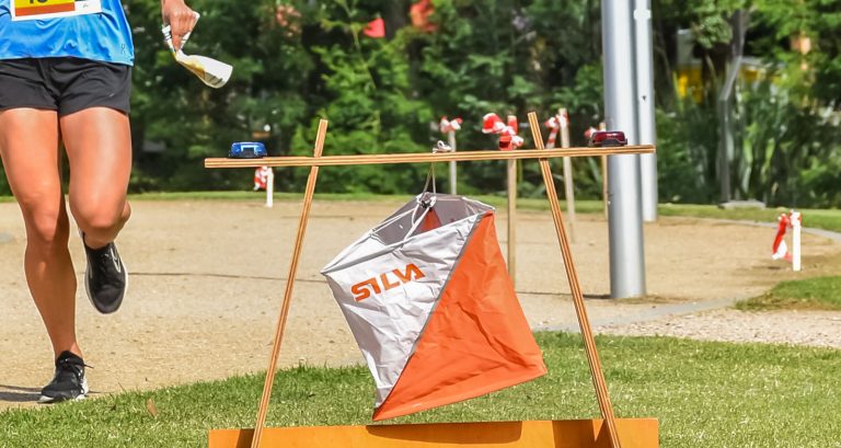
When you do your orienteering course, you normally have an orange and white flag at each control. There is a special electronic punching unit to record your time. The flag and electronic units are on a stand or chained to an object.

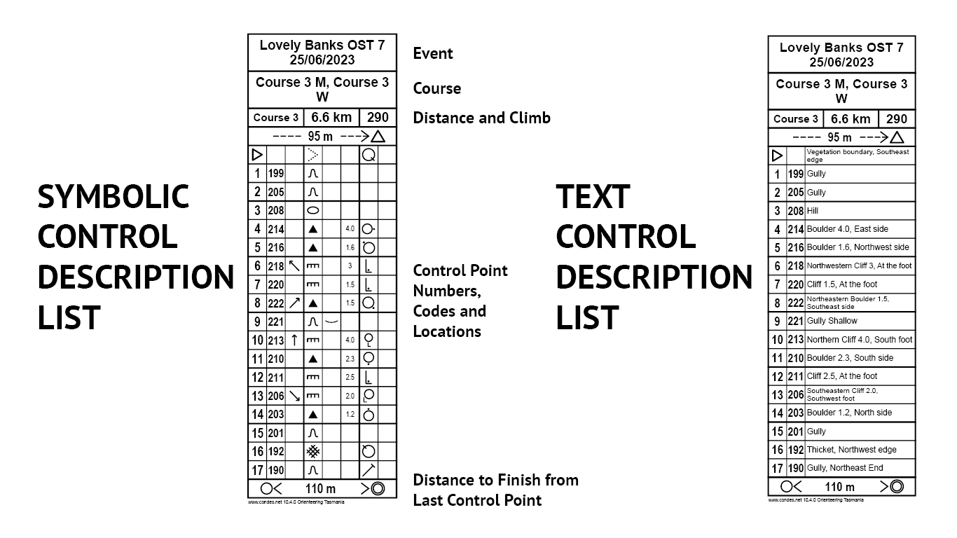
The control points on a map are located in the centre of the control circle on the map. A control description will help you to find it. The description will tell you where the control point is within the circle. For example, it could tell you that it is the northern rock which is 2 metres high, and the control point flag will be located on the southern side of that rock.
Control point descriptions in Australia use either the international symbols or are in English. Check out this control description guide for everything you need to know.

Orientate the Map – Align the map with the features that you actually see around you. If you can see a road for example, align the map so that the road on the map is parallel with the real road. Keep the map in front of you so that you can easily read it. The map should stay orientated or aligned to the corresponding real-life features.
Fold the Map – The map is easier to read and handle if it is folded. Fold the map so that you can see all route choices for the area that you are about to navigate through.
Reading the Map and the Ground – The map is a 2D representation of the real-life 3D world. A secret to orienteering success is being able to match:
Plan your Route – To get to each control point you need to plan your own route. Think about:
Attack Points – It can be hard to find a control point on a small feature in a large park or forest. To reduce your margin of error, it is usually easier to navigate to a more distinctive feature that is close by. This is your ‘attack point’. From this feature you go on to the actual control point location.
Check out the links to find out more about getting started in the different types of orienteering held in Australia.
BUSH ORIENTEERING – The traditional form of orienteering usually held in a non-urban forested environment where courses vary in distance and levels of technical and physical challenges.
MOUNTAIN BIKE ORIENTEERING – Like bush orienteering combining the joy of bike riding with the fun, challenge and excitement of orienteering. Usually held in forests with track networks it’s a great way to explore and ride more of Australia.
PARK/STREET ORIENTEERING – The fun, flexible type of orienteering often held in the parks and streets of Australia’s major cities.
SPRINT ORIENTEERING – The short type of orienteering with lots of control points usually held in city parks, university campus, schools. and other urban settings.
